Departure from Santa Croce di Alassio
Let's start from the beautiful church of Santa Croce (by the way final stage of another our trip, the Via Julia Augusta), after leaving the car in the car park above the terrace overlooking the sea.
Climb to the saddle
After a few meters of the panoramic Santa Croce road, before a large white villa, a sign indicates the path to Monte Bignone. A precautionary indication regarding the times: 1 hour and 40; it will take less, including photos and chatter, and even certainly not being lightning! The path immediately climbs into the scrubland, touching a telephone repeater and a stone ruin. Oh, an apple tree already in bloom, but here in a few days it will all blossom. As you continue, to the splendid view of the bay of Alassio, you can add a view of the port below, and to the east of Albenga and the island of Gallinara. After half an hour, between the rocks and a group of very decorative maritime pines, there is a nice meeting: nothing less than a "seeker" of wild purple asparagus!
The viper trail
After the last maritime pine tree (lonely, a bit detached from the others), after a few minutes you find yourselves on a saddle. While in front a small group gives in to the flattery of a stuffed sandwich (of purple asparagus?), placing yourself on the sides of the path, you continue undeterred. Cross the "Sentiero della Vipera": here a video by Franco Giansante show the atmosphere of the places well (in fact the bikers are not lacking!). At the crossroads, continue on the steepest slope and at the next junction (SPEA card) turn right.
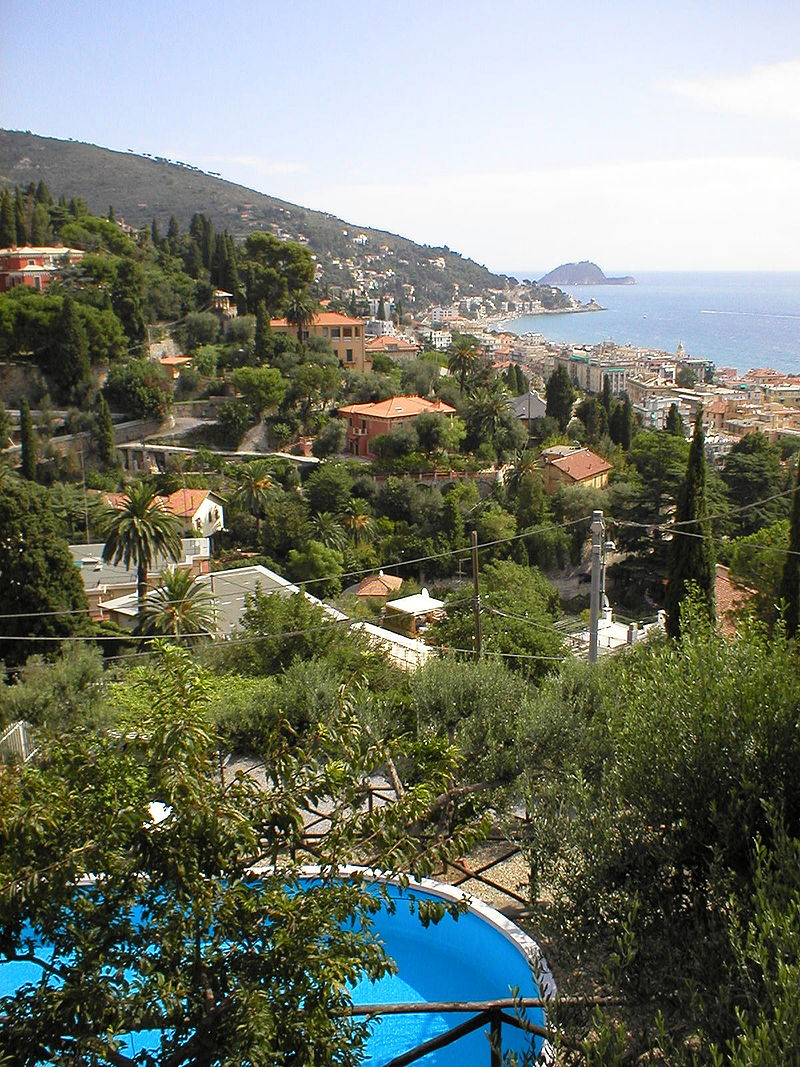
[View Alassio-Gallinara]
Monte Bignone
Cross the mountain halfway up the hill and then continue up the slope and bend left on the ridge (path coming from Albenga) until you reach the top of Monte Bignone. Here you discover a cross and the ruins of a small barrack. And also a comfortable terraced lay-by, from which you enjoy the magnificeView Alassio-Gallinara, nt 360 ° panorama: the sea and the bays, Gallinara, but also the snowy Maritime Alps, the vast Plain of Albenga, the Carmo mountain of Loano, Capo Noli ...
Now awaits the return in descent. In three quarters of an hour you will be in Santa Croce.
Start of the itinerary (Google maps)
GPS coordinates: 44.0176191,8.1902856
Signpost: a full red roadsign to the path from Albenga, then 2 full red roadsigns.


: with snowshoes to discover little villages and breath-taking views")